| Page 1 2 3 4 5 6 7 8 9 10 11 12 13 14 15 [Next PAGE] [NEXT 3 PAGES] There are 365 records in p4A database matching your search criteria. Displaying the 300 most recent items [Return to Database Search Page] |
| You may click any of the images below to view the details for that record. |
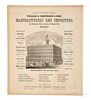
Shop & Trade; Horstmann & Sons, Altas Page, Military Goods & Dress Trimmings, Factory View, 1856, 18 inch. |

Atlas; Brown (Lloyd Arnold), Early Maps of the Ohio Valley, 1st Edition, 1959. |

Atlas; Lathrop (JM) & Penny (HC), Atlas of Belmont County, Ohio, 1888. |

Atlas; Walling (HF), Atlas of the State of Ohio, 1869. |

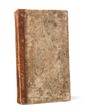
Atlas; Walling (HF), Atlas of the State of Ohio, 1st Edition, 1868. |
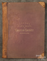
Atlas; Caldwell (JA), Caldwell's Atlas of Harrison County, Ohio, 1875. |
Atlas; Mitchell (S Augustus), Mitchell's New General Atlas, 1862. |
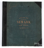
Atlas; Hopkins (GM), City of Newark and the State of New Jersey, 1873. |

Atlas; Wayne (CP), Life of Washington, Vol 6, Revolutionary War Maps (10), Battlefields & Troop Movements, 1807. |
Atlas; Carey (Mathew), Publisher, Pocket Atlas, 20 Engraved Maps, 1820. |

Atlas; Mills (Robert), Mill's Atlas of South Carolina, Limited Edition Reproduction, 1965. |
Map (12); Parker (Lucy Elizabeth), US & Europe, 1836-7, Hand Colored, Bound, 9 inch. |
Atlas; Kirk & Co, Breou's Farm Maps of Chester County, Pennsylvania, 1883. |
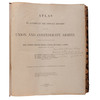
Atlas; Cowles (Calvin), Atlas to Accompany the Official Records of the Union and Confederate Armies, 1891 to 1895. |
Atlas; Beers (DG), Atlas of the State of Delaware, 1868, 26 Maps. |

Atlas; Mills (Robert), Mill's Atlas of South Carolina, 1965, Limited Edition. |