| Page 1 2 3 4 5 6 7 8 9 10 11 12 13 14 15 [Next PAGE] [NEXT 3 PAGES] There are 2983 records in p4A database matching your search criteria. Displaying the 300 most recent items [Return to Database Search Page] |
| You may click any of the images below to view the details for that record. |

Map (2); Blaeu (Willem), Europe, Low Countries & Northern Germany, ca 1635. |

Globe (2); Newton & Son, Celestial & Terrestrial, Victorian Mahogany Stand, 40 inch. |
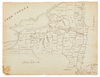
Map; New York State, Hand Drawn, Lead & Colored Pencil, ca 1820, 10 inch. |
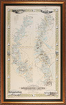
Map; Persac (Marie Adrien), after, Plantations on the Mississippi River..., 1967, 53 inch. |
Map; Sheafer (PW), Historical Map of Pennsylvania, 1875, 39 inch. |

Map; French, Easter Island & Cook's Bay, 1786, Engraving, Hand Colored, 34 inch. |

Map (2); Dapper (Olfert), Amsterdam, City Plan, Copper Engraving, 14 inch. |

Map; Homann (Johann B), Regni Mexicani...Hispaniae, Sovereign Mexico, ca 1720, 22 inch. |

Map; Blaeu (Willem), Insulae Americanae in Oceano Septentrionali..., Caribbean, 1635, 20 inch. |

Map (2); Boisseau & de la Mare, Paris, 1645 & 1705, 20 inch. |

Map; Homann (Johann B), Typus Geographicus Chili a Paraguay..., South America, 1733, 22 inch. |

Map; Thomson (John), Spanish North America, 1814, Hand Colored Engraving, 24 inch. |

Map; US Army, Corps of Engineers, Military Map of Sherman's March To The Sea, 1865, 44 inch. |

Map; Delisle, Regionum Italiaemediarum Tabula Geographic, Regions of Italy, 1711, Engraving, Hand Colored. |
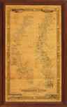
Map; Persac (Marie Adrien), after, Plantations on the Mississippi River..., 1967, 52 inch. |

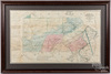
Map; Mitchell (S Augustus), Plan of New Orleans, 1872, Lithograph, Hand Colored, 11 inch. |